 Image 1 of 1
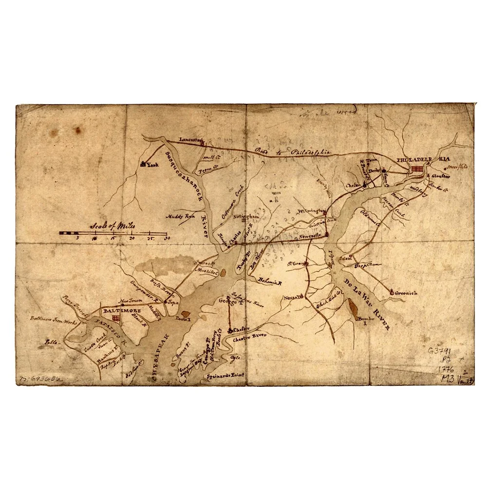
Map of the country between and bordering the Delaware River and Chesapeake Bay, showing roads to Philadelphia and localities.
Created/Published :
1776
Notes:
Scale ca. 1:670,000.
Title from P. L. Phillips' List of maps of America.
Manuscript, pen and ink and pencil.
Label on verso has title: Eastern Pennsylvania, Maryland, Delaware and New Jersey showing roads.
Original Medium:
Colonial map on sheet 19 x 31 cm.
Repository:
Library of Congress Geography and Map Division Washington, D.C. 20540-4650 USA


